Literally miles of old trails, utility right of ways and old logging and Crown access roads wind their way through the forests and between the lakes making North Frontenac Parklands a hiker’s paradise.
Take your camera as photo opportunities present themselves at almost every turn in this natural wonderland. Capture memories of the abundant flora and fauna or some of the breathtaking landscapes and views.
Hiking opportunities exist from nearly every campsite in North Frontenac Parklands. Whether following existing roads and trails or simply exploring the diversity of the terrain and nature around your campsite there’s plenty to see!
Schooner Trail
The Schooner Trail is a newly marked hiking trail through natural forests, featuring many large boulders, a high elevation scenic jaunt, and a steep limestone hillside, all on the west shore of Long Schooner Lake. The trail heads north from the end of Schooner Road, then zig-zags northwest up the “The Climb”, and swings back east along the “Upper Ridge Walk” toward Long Schooner Lake. The trail finishes with a quick and steep descent to a nice mellow lakeside walk along Long Schooner Lake, and it then meets back to the beginning of the trail. The entire loop is approximately 3 kilometers, and covers just over 100 meters of elevation.
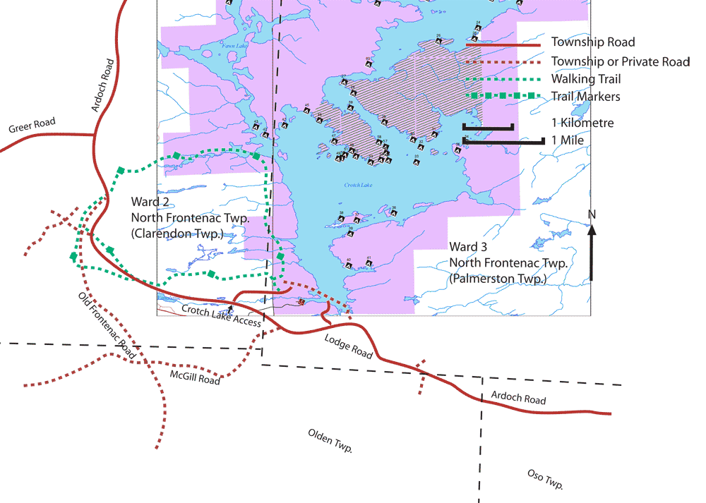
Crotch Lake Trail
The Crotch Lake Trail is a marked walking trail through the natural wetlands and forests between the southwest shore of Crotch Lake and Big Gull Lake. The trail heads west from the south access road to the lake, then swings north past the eastern tip of Big Gull Lake before it loops back west toward Crotch Lake and curves south parallel to the southern portion of the west shore of the lake. The entire loop is approximately 20 kilometers. -This trail is maintained by volunteers-

The Palmerston Canonto Conservation Area (PCCA) Trail
The Palmerston Canonto Conservation Area (PCCA) includes 7 hiking trails ranging from 300 meters to one kilometer in length. Community volunteers and the Township of North Frontenac formed a partnership to not only restore these trails but maintain and monitor the close to 5 kilometers of paths. These trails enhance the outdoor life of residents and visitors, and promote activity that fits within a healthy lifestyle. The trails are colour coded with line of sight markings making it easy to reach either of the two summits – the Lakeview and Vista Lookouts. Maps along the way make navigation very convenient. The trails start from the dam between Palmerston and Canonto Lakes and include back country levels of hiking that can be enjoyed by everyone.
Click for the Palmerston Canonto Conservation Area Trail Map

Directions
Visit ‘Hike Ontario’ for information on finding your Trail in Ontario.
.
.
.
.
.